Experimental Forecasting System for South Florida
Published:
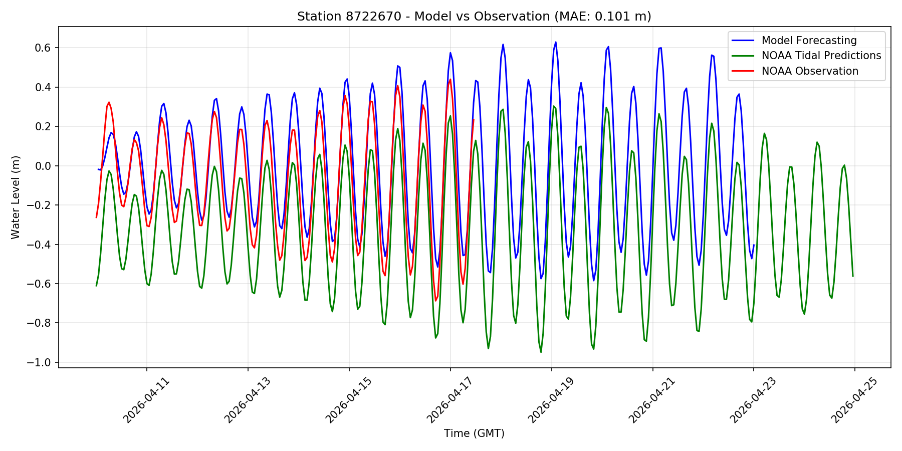
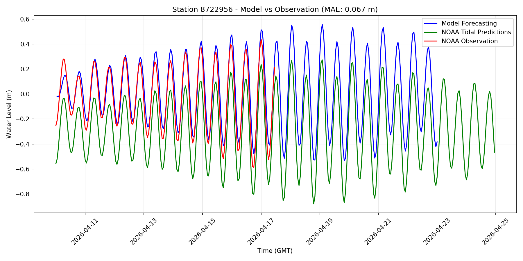
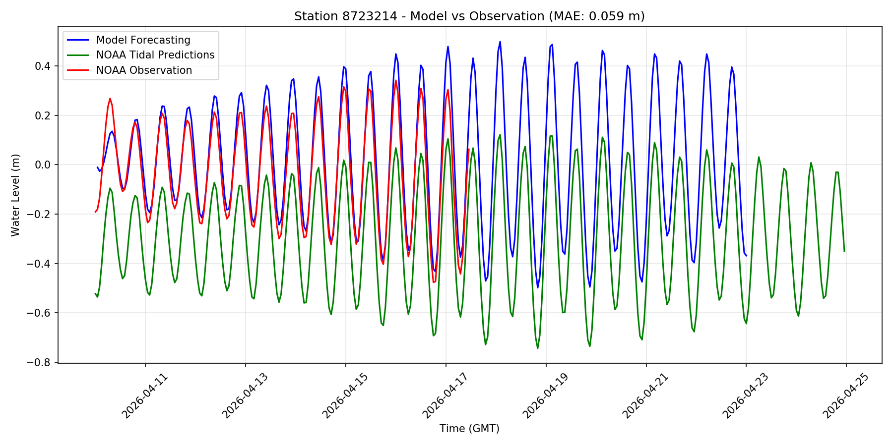
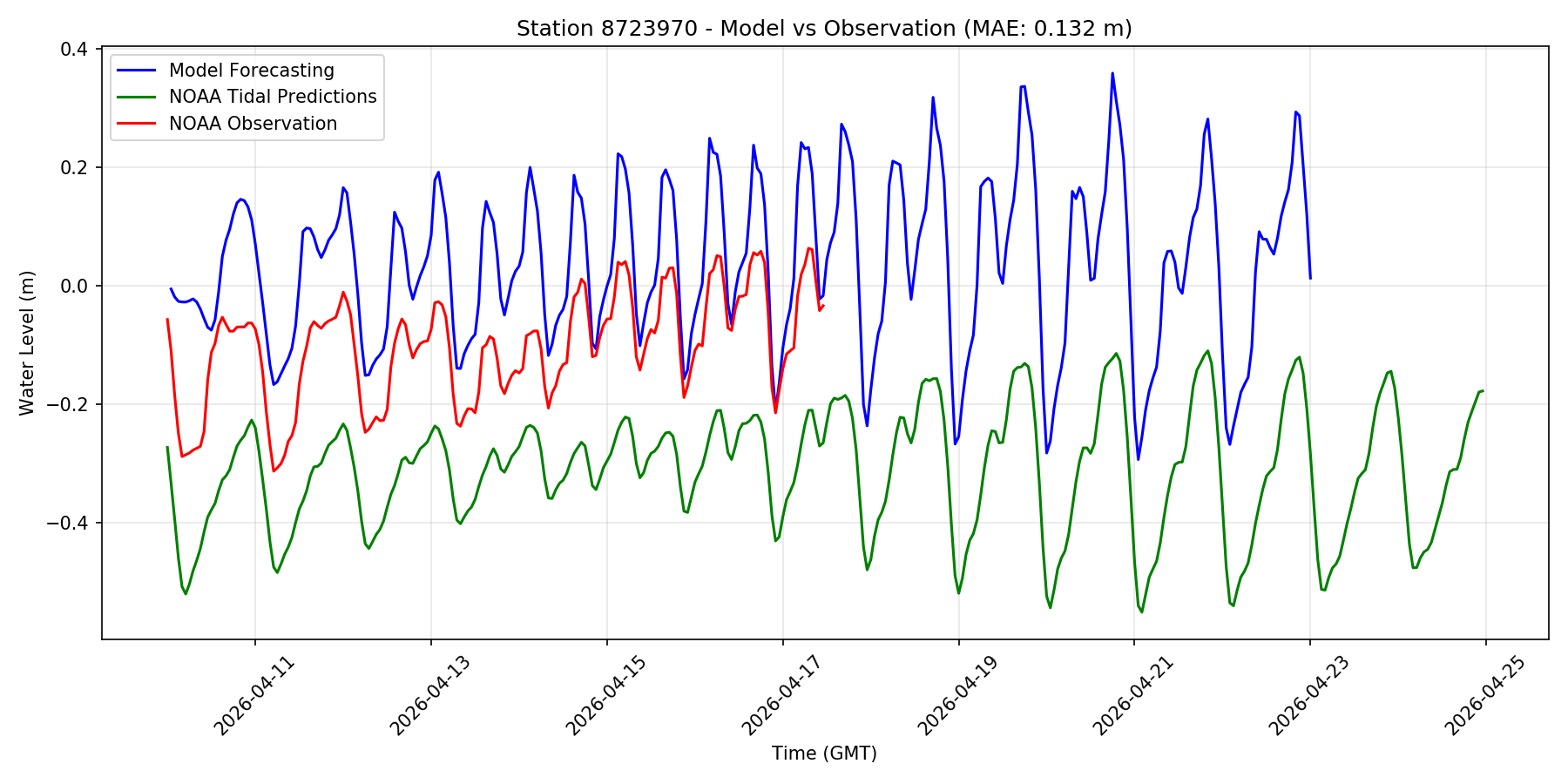
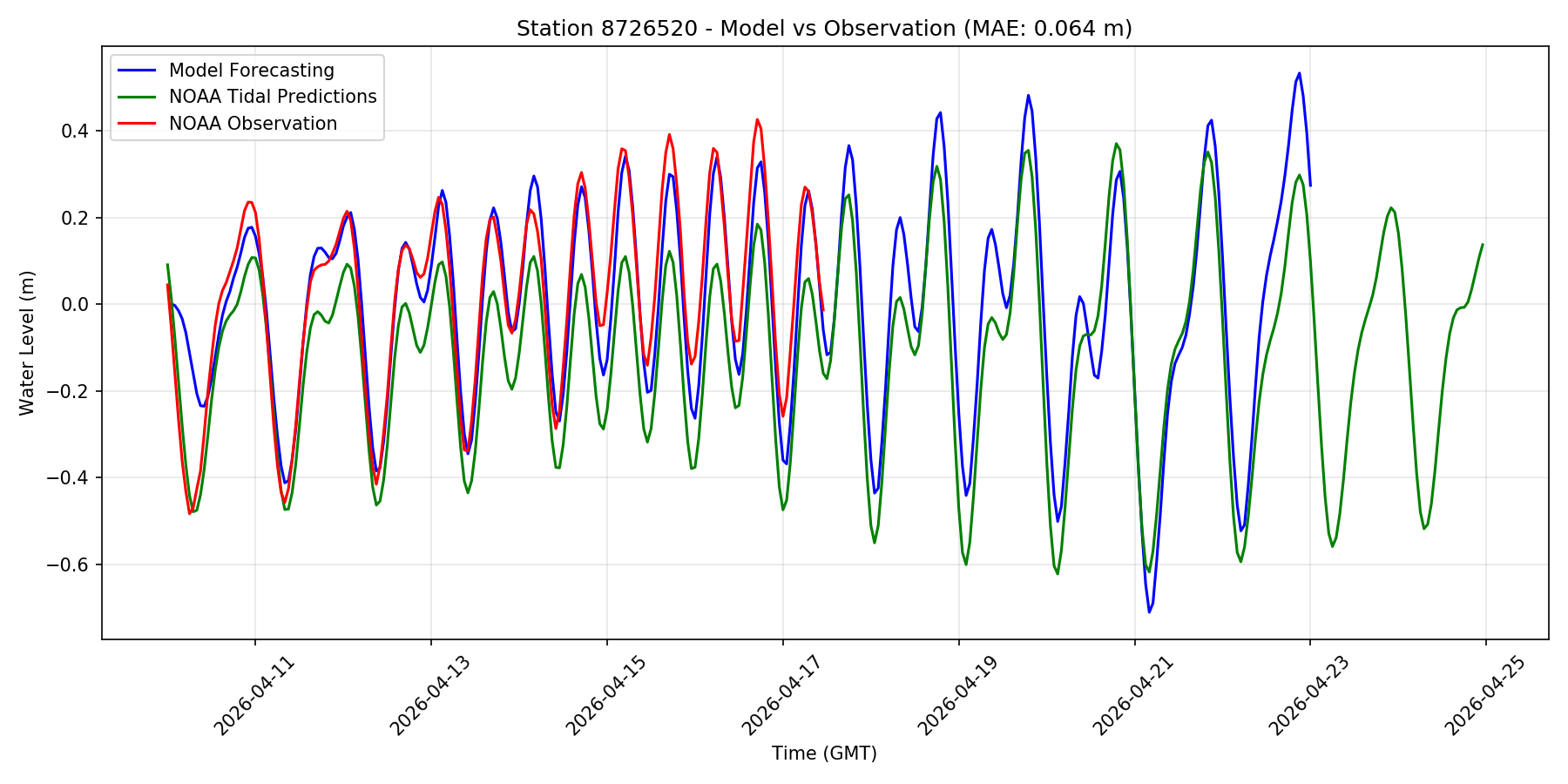
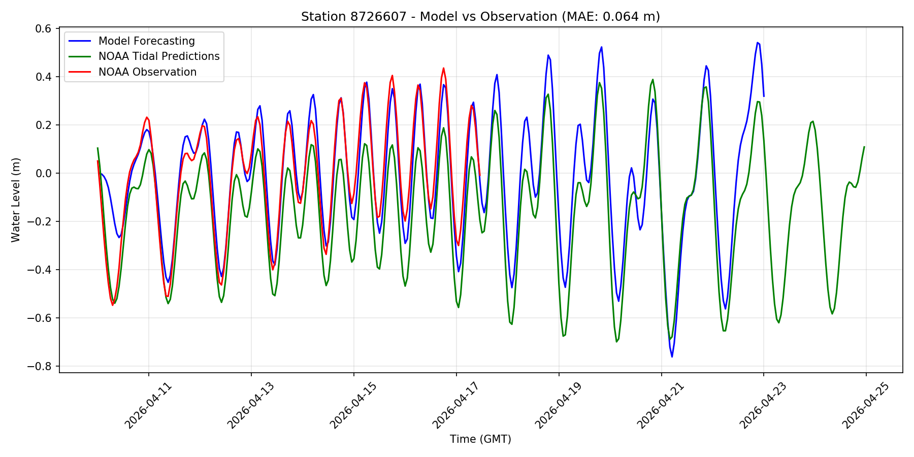
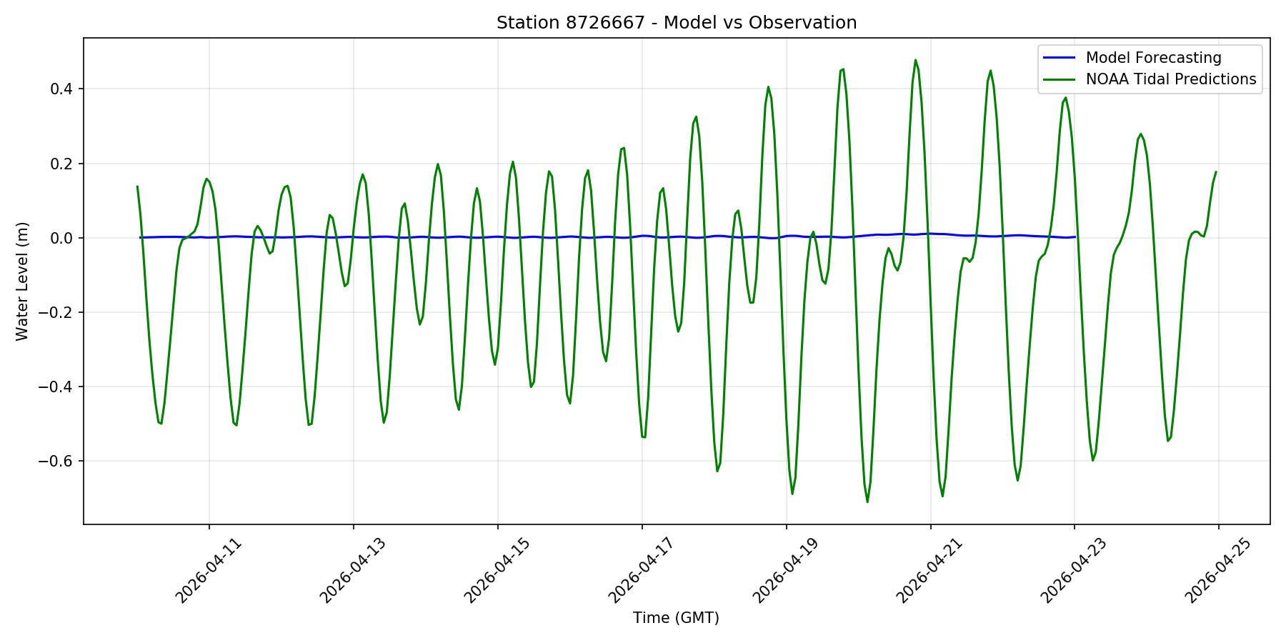
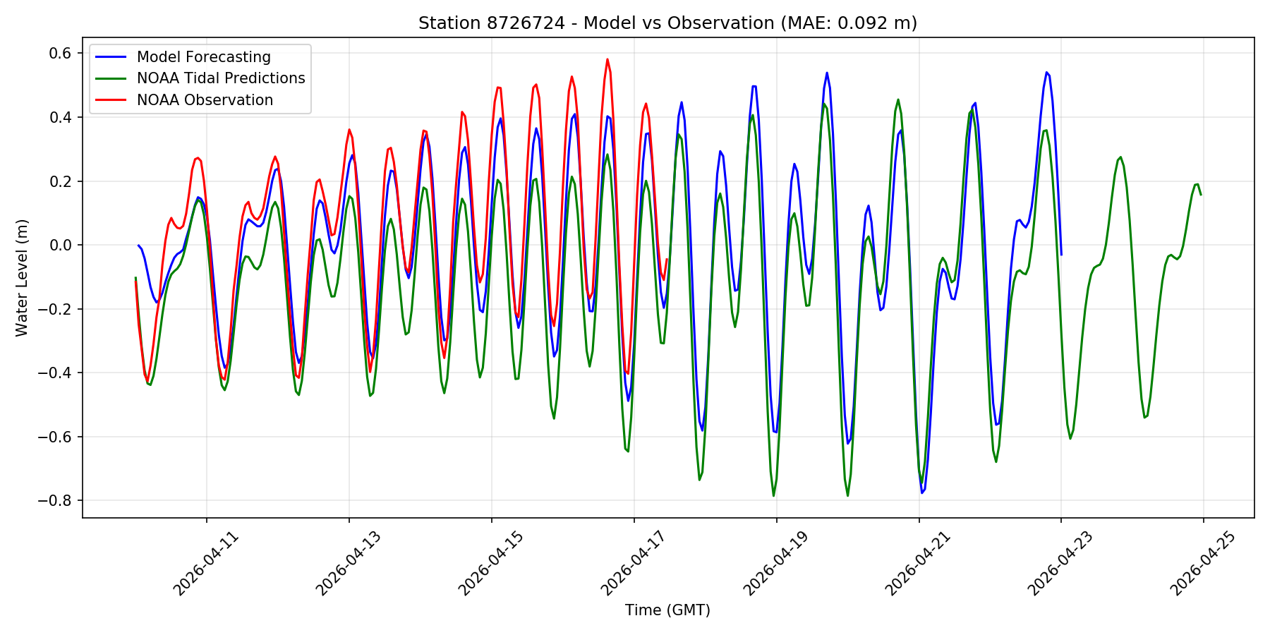
Disclaimer: This is an experimental web portal for graphic visualization of the operational and experimental results from the storm surge and tide forecast systems being developed and tested by our lab at FIU using SCHISM.
It should not be used as an official forecast.
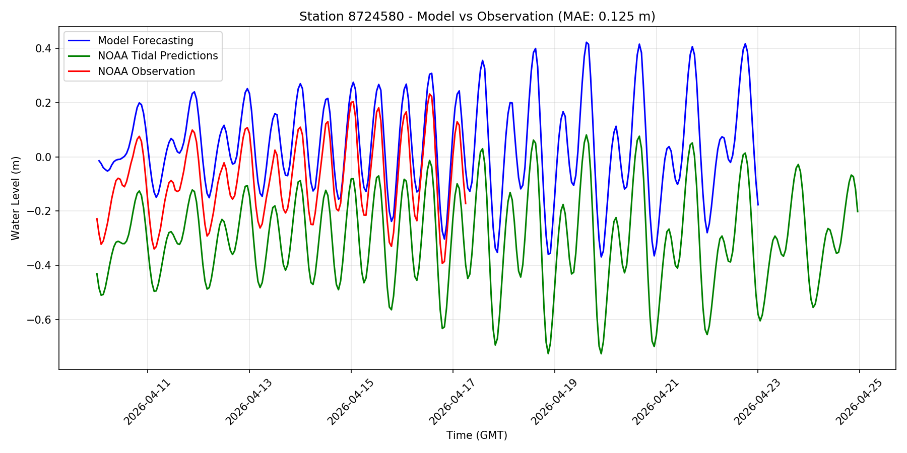
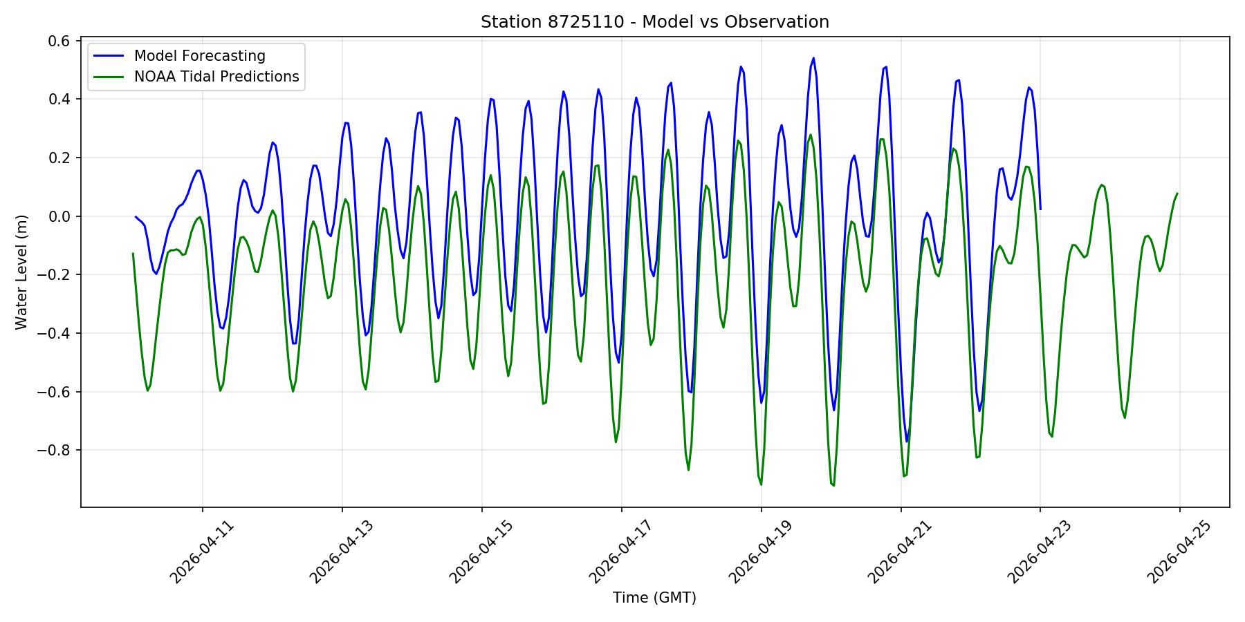
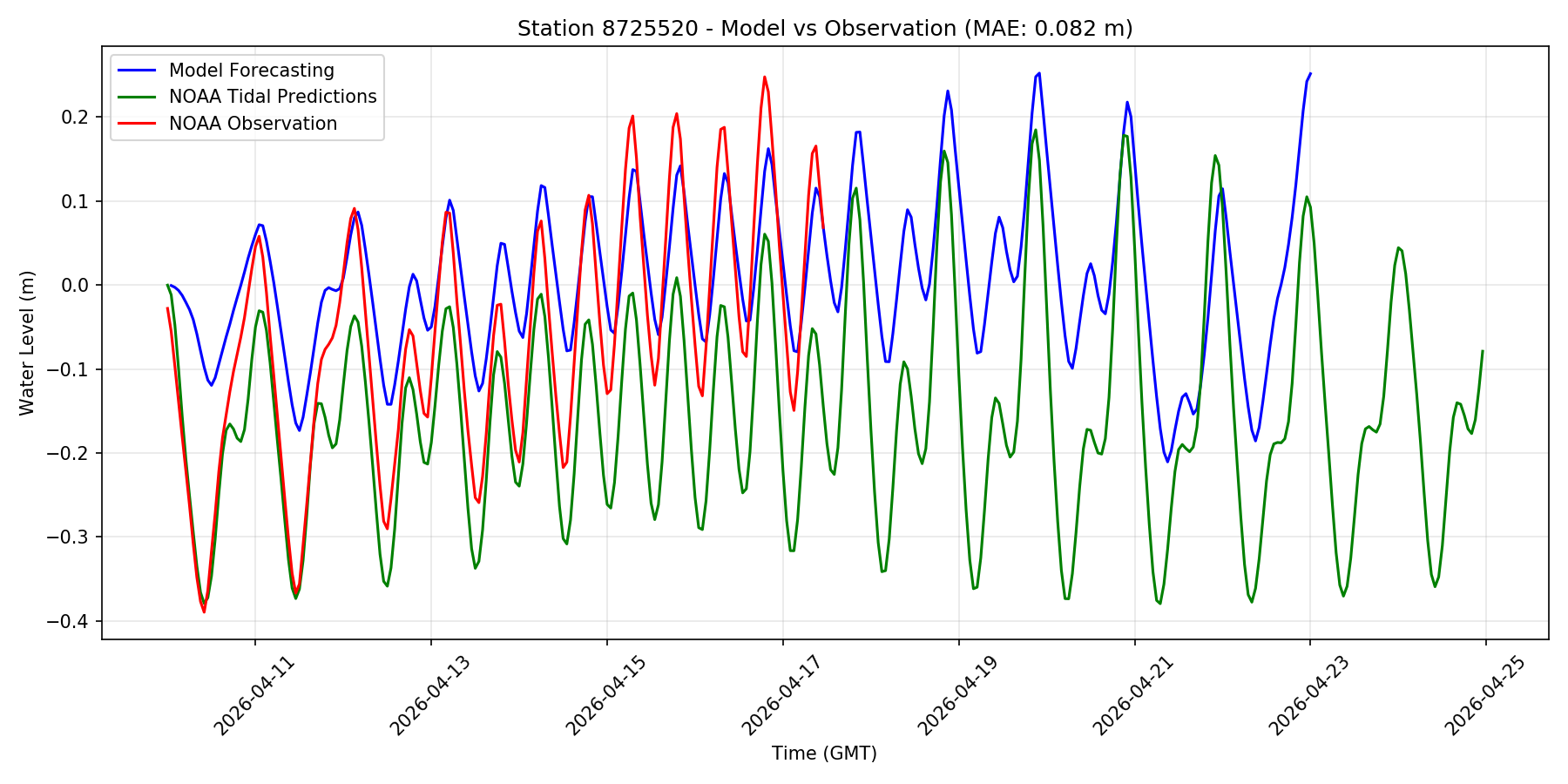
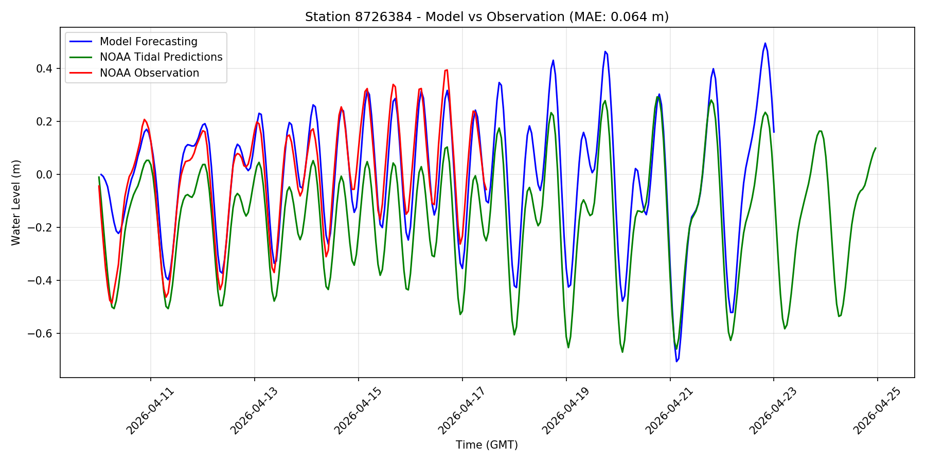
The map below showns observational stations used for validating the model’s results, as well as the horizontal grid.
The horizontal grid for SCHISM in simulating Biscayne Bay in South Florida, using flexible resolution resolving levees and canals (1-2 m), watershed rural and urban areas (30m-50m) and coastal ocean (500m-5km).
Turn off the hgrid to accelerate the display speed.